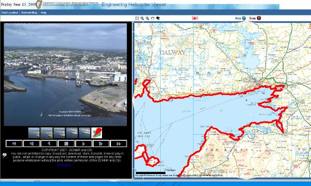
Irishmarinelife came across a fascinating site this morning; a virtual helicopter tour of our shoreline. This appears not to be new; the images are dated from 2004, however it is a stunningly comprehensive look at our entire coastline from an aerial vantage point. The site appears to be under the responsibility of The Department of Communications, Marine and Natural Resources.

Sourced from epa.ie website
It’s utility is impressive, the fact that it covers in a continuous photo collage every metre of our coastline (excluding Northern Ireland) means it is useful for a range of interests. A quick review of it reveals for example the extent of our coastal defence structures.


Cool, but is it for public access, website name gives impression of internal tool, any ideas? heaps of fun
Posted by Charles | July 3, 2009, 11:21 amcant believe I havent seen this before, its nuts
Posted by cuain | July 7, 2009, 1:19 pmhow oh how was i able to even live without this before,
screw google earth!
(and rainy days)
Posted by Leo | July 8, 2009, 10:06 pm